Non electric range finders

Status
Not open for further replies.

kBob

Member
Joined
Jun 11, 2006
Messages
6,459
Location
North Central Florida
As a prehistoric Artilleryman I used the stadia lines in Military binocs for range finding good enough for calling fire with.

These days it seems everyone has an electronic range finder with a laser for a heart that tells range to an accuracy of half a gnats butt at 900 meters.

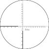
So anyone else use stadia or mildot range finders? Care to tell us about it?

While I was briefly assigned to an Position as and infantry fire team Grenadier and armed with an M16A1 with an M203 slung under the barrel I noted how important it is to know range for a weapon that at best can only shoot a quarter mile at optimum elevation. I had earlier trained on the M79 and noted the importance of accurate range estimation.

At the time I longed for a Rangematic Ranging 600, but on a PFC's pay they were beyond me.

Anyone have experience with Optical Coincidence range finders like those and want to share?

-kBob
 
I’m all ears. I’ve been working on learning to use mils for ranging. Seems to work, but I’m incredibly slow doing it, like I could shoot and reload a musket 4 Times before getting the range.
 
Stereoscopic rangefinders were hugely expensive, not many civilian versions were ever available, and their size made them impractical for field use.

Milling for range - that is reading target apparent size corresponding to actual size, was pretty common in its time, but it’s time has certainly passed, unfortunately. The precision just isn’t there, and it requires knowledge in the shooter, which is never popular. It’s not difficult or time consuming, but if you asked the average deer hunter, it’s prohibitively so... The precision is the largest downfall. Outside of about 400yrds on game sized targets, milling falls apart.

I did have a parallax rangefinder in high school - basically a monocular with a reticle and a graduated side focus knob, or a rifle scope without an adjustable erector tube. Get the reticle in focus on the target and it gave you range on the knob. It also wasn’t precise enough for long range work.

I’ve also owned a hiker’s rangefinder, I forget the actual name - just a length of string with a brass bauble on the end with a view window and a sliding cross bar. Hold the knot on the string in your mouth, extend the bauble to pull the cord taught, and bracket an object of a certain height. Lock the crossbar and read the range mark. Absolute disaster for long range shooting, as it was scarcely more accurate than a WAG.
 
Owned and (tried) to use optical rangefinders years ago for bowhunting and varmints. I think I still have 80 yard unit somewhere. Basically they were horrible, but better than nothing. With the low cost and easy of use of modern laser rangefinders, I see absolutely no reason the use the older technology. I saw basic models on sale last fall for under $60 at the Field & Stream store.

Mil-dots were certainly popular for a while. Honestly I couldn't get any real use out of it or the Christmas tree stadia line retical. For most practical situations i think the best results have come from the old standard point blank zero: +2-1/2 @ 100 and hold dead on out to 350-ish. Past that range if there is time to get a steady rest, it's just as likely time to laser range the target. Of course that's just my opinion. Surely others have found a way to make them work better than I could.
 
I was not impressed by the only Rangematic I ever fooled with.
At one time you could get the Swiss Wild rangefinder pretty cheap. But it is five feet wide.
 
Hmmm, no one mentioned the Sheppard scopes or the Letherwood ART. I played ONCE with an ART and it seemed a good for military use.

The Sheppard Scopes were fixed power and had a set of rings of progressively smaller size on the verticle cross hair. Each ring subtensed 18 inches at a given range and the scopes were set up for a specific caliber and load. Choose the circle that fit and 18 inch target and the range was on for that rifle and scope.

The ART on the NM M14 and "M21" system used stadia lines on each leg of the cross hair. Verticle lines were 18 inches and horizontal lines were 36 inches at a given range One adjusted the power of the 3x9 scope until the target of that size fit between the lines and the "Auto Ranging cam and levers adjusted the elevation to deal with that range. WHen it was broken and no longer "Auto Ranged" One still found the range by adjusting the power and simply reading the power setting as hundreds of meters to 900 meters.

Now military shooting can have some known sized objects to help stadia range finders such as mil dots work better. Given various trucks and armored vehicles as targets I did some fairly accurate range finding with military binocs to 3000 meters. Now by that I mean to with in 35 meters at 1600 meters whish means 155mm gun howitzer frags WILL fly about and on the target if the guys doing the math at the guns do their job right.

I found US military maps to be excellent "Range Finders" though a hunter would consider them sloppy. They mainly helped in establishing a range card. If I know a ridge line is 800 meters away and the horse shoe bend creek at the bottom of the hill I am on 550 meters away then I know things between those to points immediately to be more than 550 and less than 800 meters. Now I have something to guestimate with or what we called SWAG for "Scientific Wild A## Guess" Gosh that big old rock is about half way between creek and ridge best I can tell, so its at maybe 675 meters and the target is less than a third of the way to the ridge from there so call it maybe 40 more meters and figure my fire mission for 715 meters in that direction or set up the M60 GPMG or M2HB and hope the gunner properly zeroed the sights and set them for 700 and let fly. Anytime we stopped for more than three or four minutes a new range card got started. Figuring out where we were was constant.

Now the kids have alsort of electronic gadgetry, but not that long ago one of the jobs of a Cannon Batter XO was to know were he was ALL THE TIME even driving down a road way. We were expected to do what was called a "Hip Shoot" A priority fire mission might come in while a battery is "Displacing" that is moving from one planned firing position to another. If Division Artillery decided the priority was high enough a battery in transit simply pulled off the road and pointed in an assigned direction, initially with e XO simply pointing for the base gun to point in the general direction. He then walked behind each gun as they backed onto their spades and opened the rear doors and used a hand held compass to give direction by looking along or through the tube. This right away is going to mean ragged sheathes ( the impacts will not be on line a school pretty) but he has to know where he IS. He has to trust his battery to look out for threats while he constantly keeps track of where he is......as in the jeep stops and right then he needs to be able to say where he is within 300 meters and over the next minute or so while he is giving the guns direction he has to figure out the position of the base piece to "PDC" (pretty darned close.)

Now "survey standard" is direction to within two mils and position to within two meters and that ain't going to happen. Still with in a minute or two of stopping location will be correct to with in generally 25 to 50 meters, with a US GI map, a hand held compass and a M1 Brain.

If you are hunting over a specific area repeatedly and an area that range matters it should not be hard to build range cards for several way points in that area. This is why we trained in the same "battle areas" in Europe in the seventies that we expected to fight in. The village of Schlitz (no really it is where the family came from) and its two steeples and big water tank on the hill over the village are not going anywhere. Where the dirt road north from that horrible garden gnome collection lived was in the same spot everytime I saw it. The survey bench marker near the cut in the old road did not get up and wander around and I knew it to be 120 metes due west of the cut.

Knowing where you are and where know objects are greatly increases your ability to tell where "new" targets amongst all that are and therefore the range from you to them.

I like firearms from 4mm zimmer shutzen to 8 inch howitzers, but honestly a good set of maps and decent reliable compass are about as important in the field for military ops for pre GPS days.......and a few bucket loads of BBs dropped into certain orbital patterns or some advance Electronic Warfare might make those skills just as valuable today.

BTW the US and NATO decided to round up "mils" on their equipment to be 6400 mils in a circle (easier work with than 6283. whatever) while the Soviets and Chinese went with rounding down to 6000. Something to know if you are buying some of the neat surplus out there these days. Some soviet guns had built in mechanical "Computers" The D30 122mm towed had a cone shaped drum that one set up to the desired range from the gun rather than elevating to a specific angle in mils and the gun had an adjust able azmith ring set up for their 6000 mil system so a gun crew knowing only the range and direction of a target from their position could lay and fire with out a third party figuring firing data. Not as accurate as us but pretty darned quick and pretty darned good. Wholly mechanical.

KISS......Keep It Simple, Stupid

-kBob


Hi kBob,

I enjoyed this post. It was full of good information. It made me think of a question I've had off and on over the years. You probably don't know the answer but maybe...

Where does a person find good maps of largely rural or wild terrain in the US? I see the road atlases in the big bookstores, but they're useless in the bush. I've often wanted good maps for rural and wild country. But where does one find such things?
 
DeLorme used to publish atlases of quadrangle maps. Maybe too small scale, getting a state in one book, but much more detailed than road maps.
Can you not still get real USCGS quad maps?
 
It seems like some computer nerd could develop a rangefinding 'app' for the smartphones.

They have them and they use a variety of strategies none of which are nearly as accurate as a laser range finder. The often require known data inputted outside the sensors built into the phone, or you have to take measurements from two or more locations to arrive at a range.

A simple app works with you inputting the know height of the camera off the ground. Assuming the ground is level you can get a decently range measurement simply using the camera and internal accelerators to estimate the angle the camera is pointed at with respect to the level ground. Then it is just a simple trig problem. It become increasingly more inaccurate as the ranges measured get longer. A similar triangulation can be done with the internal compass and camera but required one to move laterally to make the measurement using the GPS to measure the lateral move.

I played with optical coincidence rangefinder when I was a kid. My dad had one that would range out to 1000 yards. Cool gadget but again it became less accurate the further out the range got.

I currently use a laser range finder. Simple to use, very accurate, and getting cheaper all the time.
 
Last edited:
The Sheppard Scopes were fixed power and had a set of rings of progressively smaller size on the verticle cross hair. Each ring subtensed 18 inches at a given range and the scopes were set up for a specific caliber and load. Choose the circle that fit and 18 inch target and the range was on for that rifle and scope.

I know a guy who had a Sheppard on his elk rifle. After he shot an elk at some extreme range, I asked him which ring he used to range it. He said "I just held over his back and cut loose, hit him on the second try.
Frank DeHaas had his son comment on Viet Nam era sniper rifles with the Redfield ranging system. He said they did not use it, scopes were set at maximum 9X or maybe 8X if it gave a clearer image and left there. They used traditional range estimating methods.
 
Although I have not used the downloadable free USCGS maps they can be googled and then downloaded. Appearently directly to things like a Garmin GPS.....being an electronics illiterate other than posting on web boards I would not know. Given the size of the original maps I would guess that limited to an 8 1/2 X11 printer that one would have to cut and paste...or at least just paste to get full size maps and scale accordingly.

That is sort of the opposite of my old Division Artillery "Battle Book" This was a large ring binder that had the area of Germany we were supposed to defend on real maps cut into 8.5 x 11 pages and tabbed in an orderly manner.......sort of like what DeLorme does for their A&Gs. Pages of areas we trained or already planned to fight from were laminated so I could use markers on them then erase without destroying the map or its utility. Also I had spare pages for some areas. In one respect I hated this big bulky binder that was almost attached to me as it was a PITA to cart around and keep up with....on the other hand I was required to keep it under armed guard and so carried in Europe pretty much 24/7 and my boss authorized Personally Owned Weapons to keep the paper work and need for other folks doing work to a minimum. It also contained target lists, standard ammo plans and pages to grease pencil in actual ammo counts for the 155mm and 8 inch guns down to Battery/section level, approved water points, initial unit positions, pre surveyed positions......all the sorts of things "bad guys" might want to put a hurt on our Division Artillery assets. Basically I got to be a one man backup DivArty Opertions center.

BTW when the Army decided to automate with the then new TACFIRE system based on computers and hand held calculators our Colonel decided to bring in all the old mechanical devices for running artillery and had a symbolic bon fire where some were burned. These were the dreaded "Charts and Darts" of "old" Artillery days. We used slide rules purpose made to figure firing data, purpose made protractors and push pins to physically plot targets on either a map or a gridded other wise blank target board. There were "firing tables", little brown books that had pages of data on what range to expect with what load at what angle. I refused to turn mine in and kept them in my traveling office (a foot locker in my jeep trailer). Up to the boarder for the very first actual TACFIRE exercise in Europe and.....the system broke down in about the first hour. Suddenly my paper maps, slide rules, protractor, books and even box of push pins and variously pointed pencils were very valuable.

No doubt now things have greatly changed computer wise from the early 1980's when they were made with stone knives and bear skin, but I have to wonder if some old Red Leg keeps his charts and darts ready and pencils sharpened properly.

There are De Lorme "Atlas & Gazetteer" books in each of out vehicles for our state and I have a couple for the bordering states and places we are likely to go. While they did not bother with contour lines for Florida, they have them for other states.

-kBob
 
I played with the Rangematic 1000. Not impressed at all.

The 19th Century marksmanship manuals had instructions for using the MK I eyeball for distance estimation. See if you can find it and practice it all the time.
 
Most guys I knew that had been assigned in an Army unit to use a scoped M-14 told me they used the lowest possible setting to obtain a good sight picture with. As most shooting was less than 400 meters this meant the scopes got used mainly on 3 to 5 power. They went to higher power to see what a potential target was carrying so as to prioritize targets.

Major Land (Carlos Hathcock's CO and team coach and sometime sniper buddy) told me that most of the USMC shots were also under 400 and that with the fixed 8X scopes they had sometimes it took a bit to find a target. Still as an old 1000 target shooter he liked (and therefore USMC liked) the higher power scopes.

US sniper manuals of the late 1960's and 1970's encouraged shooting with the lowest possible scope setting. It was explained to me to be a two fold concept, larger Field of view for greater ability to keep up with the primary target and keep an eye on his immediate surroundings and two to give maximum light transmission.
 
Yeah something exactly like that. Still seems expensive to me though, was hoping to spend maybe $50 on one, but maybe I'm asking for too much...
 
re: maps, i highly recommend mytopo.com very very cool site lets you create custom map and get free PDF of it or pay $20-30 for a large print out, including plastic paper that is water proof. i like to do this for areas i'm going to be wandering in.

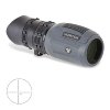
re: monocular, i have the vortex above. it's very good for some things. i wouldn't use it to range targets unless the targets are really really large. however, it's great for directing team mates to a target.
 
Status
Not open for further replies.
Back
Top