How can you measure the height of a shooting range's berm / backstop?

Status
Not open for further replies.
Let not your heart be troubled, I've been following the thread with interest.
The only thing I'd come up with was a water column level, but that would require many dozens of yards of tubing
I'm going to go back to this initial idea as illustrated by jmorris. I think I've rounded up enough hose that I can do this. But as I had mentioned, getting up to height, down in the range is really the only obstacle. I'll post the measurement if I'm successful.
Maybe get a helium balloon
No... because... wind. :)
Hope you don't hunt.
Hope you've learned to read! :rofl: I hunt, and with great success. :D
I am going to assume the reason why he needs to do this ... is to prove that he is shooting in a saFe manner
Sort of, but not really. When I talk to people about my personal gun range, they simply ask questions; "How far out can you shoot?", "Do you have steel targets?", "Do you have a pistol range?" "You need to set up a trap field.", "How tall is that dam?", etc. So when I'm asked, I've always said the dam is probably 20 feet high or so but I don't really know. Their obvious response is often, "You oughta measure it so you know!", hence this endeavor. It's been asked enough times that now I'm curious myself.
I have seen bullet holes in the ceiling at ... outdoor ranges...
Me too. Our gun club's rifle range shoots into a nice, tall backstop (outdoors). On the other side of that backstop? Yep, a US Highway.
 
Do you have a friend with a drone that is equipped with a camera? If so I think this is easy. If you know by looking it is not 100' high, here is what I would do: Get 100' of string. Tie one end to the drone. From the low point in the drawing fly the drone straight up, use the camera to watch the berm. Stop when you are level with the top of the berm, mark the string where it touches the ground. Measure from that point to the end of the string that is still on the ground and subtract From 100. That should get you close to the real height.

Mike
 
But as I had mentioned, getting up to height, down in the range is really the only obstacle.

PVC pipe will be the cheapest and lightest I would think. zip tie the clear tubing to the outside and have the "bucket" end up on the dam at ground level.

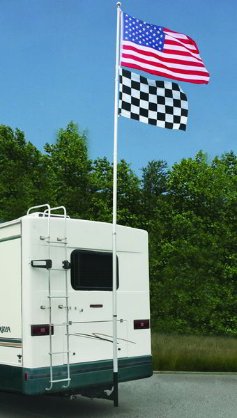
If you don't want to dig a hole or drive a T post to slide the PVC over you could always make a receiver mount like this guy did, you wouldn't need very heavy PVC if you loose the flags. It only needs to be ridged enough to stay vertical.

rv-flag-poles-hitch.jpg


If you missed it I already posted a link to 166 yards of clear tubing for $27 shipped.

https://www.amazon.com/ATP-Value-Tu...-5&refinements=p_item_length_derived:500+feet
 
I've always said the dam is probably 20 feet high or so but I don't really know. Their obvious response is often, "You oughta measure it so you know!"
You response should be: "If you care about it that much, you should come out and measure it for yourself".

I have zero patience for people suggesting that I do work of no value to me to satisfy them!
 
There's an app for that...

There are altimeter apps for smart phones. Measure your distance above sea level at ground level where the shooting bench. Then climb to the top of the dam and measure again. Subtract and you have the height.

https://www.howtogeek.com/254603/how-to-use-your-phone-as-a-barometer-or-
altimeter/


https://itunes.apple.com/us/app/my-altitude/id465262694?mt=8

If you don't have a smart phone, borrow a kid that does and get an app for the phone. Or rent an altimeter at the tool rental place.

tipoc

Barometers and altimeters are not accurate enough for what he's trying to do. Smart phones use gps to acquire a position but that isn't very precise either. Without differential correction and dual frequency receivers GPS just isn't that accurate.

If you don't believe me put your phone with the app over a NGS control point sometime and see how far it misses the horizontal position and elevation. If the relative inaccuracy were constant it would still be a useful tool if you made a differential correction but it isn't constant. The way to prove that is to use several NGS control points and look at the unrepeatable difference in error.

GPS can be very accurate (on a dime) or just good enough to keep you on your route (10 feet). Cruise missiles, aircraft and ships use dual frequency receivers which deliver accuracy within a few feet. Several DF receivers can yield the dime precision I'm talking about. That's the stuff surveyors use. The last dual freq rec I bought was 20K. The price hasn't come down much in 5 years.

I wouldn't expect very many people to know how GPS works. I started using it about 25 years ago when the first single freq receivers were made available to civilians. Then we were able to buy dual freq about 5 years later and surveyors had the real deal. Just about every surveying company now has some type of real time kinematic gps.

 
Well if the op needs the exact height then ask the county. They will have it on record, it's a dam didn't he say, dirt on one side, water on the other, then the county will have public records of the exact and official height (and the official height will be what you want, ain't it?).

The smartphone apps (or another tool) are widely used by rock climbers, hikers and others. In this case you take a reading at point "A" , write it down, and move on over to point "B" and write that reading down then subtract the one from the other and get a decent height. It is not as accurate as a surveying height, but then you don't need that do you? Because the readings are not as precise as a surveying crew can get (you can find a surveying crew by the way and offer them a case of beer!) you can take your readings in several places then figure the average.

From the sketch the ground is quite uneven from bench to berm. This means that the measurement of the height will have to be an arbitrary point that you select. That means that you will not get a result that tells you the exact height of the berm, except from that point you've chosen, and that won't be the "true" height. You could take measurements at several different spots and draw an average. But again you'll be lucky if it's within 6" or if it's close to the "true" height.

The thing is you don't need the true height.

I must have missed something in this thread earlier. I thought all he had to do was tell his neighbors how high the berm was. He's not facing a law suit, he's not looking for a permit to build something so the precise height, within 6" inches, isn't critical. So altimeter readings will provide you with that.

But like I said I musta missed something.

tipoc
 
Last edited:
Go to the home depot or Lowes or whatever you got. Buy a construction laser measure (alternately you can rent a good one for a few bucks from a tool rental joint). If it's a cheap one and only good for certain distances--work in increments. Stand a set distance from the base of the berm. Measure that distance and mark it. Now shoot at a set object at the top of the berm (or do it in increments) now you have the two distances and legs of the triangle, calculate the height from there.

http://www.homedepot.com/s/laser+measure?NCNI-5

tipoc
 
Looks like a kids toy, I down loaded it and held the device above my head and sat it on the floor, same vertical position in both places. It said the floor was higher than above my head.
Well at least you know that for sure.
 
The only measurement of height that tells anyone anything that they want to know, in this instance...will be from the bottom of the berm where the targets stand (the base of the targets) to the top of the berm.
 
Load Google Earth.

Zoom in on the range.

Place the cursor on top of the berm.
See elevation.

Place cursor at target location. Note elevation. Subtract.
Answer!
 
Well if the op needs the exact height then ask the county. They will have it on record, it's a dam didn't he say, dirt on one side, water on the other, then the county will have public records of the exact and official height (and the official height will be what you want, ain't it?).

The smartphone apps (or another tool) are widely used by rock climbers, hikers and others. In this case you take a reading at point "A" , write it down, and move on over to point "B" and write that reading down then subtract the one from the other and get a decent height. It is not as accurate as a surveying height, but then you don't need that do you? Because the readings are not as precise as a surveying crew can get (you can find a surveying crew by the way and offer them a case of beer!) you can take your readings in several places then figure the average.

From the sketch the ground is quite uneven from bench to berm. This means that the measurement of the height will have to be an arbitrary point that you select. That means that you will not get a result that tells you the exact height of the berm, except from that point you've chosen, and that won't be the "true" height. You could take measurements at several different spots and draw an average. But again you'll be lucky if it's within 6" or if it's close to the "true" height.

The thing is you don't need the true height.

I must have missed something in this thread earlier. I thought all he had to do was tell his neighbors how high the berm was. He's not facing a law suit, he's not looking for a permit to build something so the precise height, within 6" inches, isn't critical. So altimeter readings will provide you with that.

But like I said I musta missed something.

tipoc

You didn't miss anything.

All he was after was relative height from the bottom of the dike to the top of the dike and the relative height from the shooting bench to the bottom of the dike. Elev of the dike isn't important. My point was a cell phone with any kind of app is only going to give you 5-8 meters horizontal accuracy. Double or triple that for vertical accuracy. It isn't consistent either, it can be somewhere in that 5-8 meter ellipse every second or two. It's great for highway navigation but that's about it.

A clinometer and a range finder is the way to go here. The range finder replaces the tape. You're basically duplicating the method used by surveyors to find relative vertical and horizontal differences before the invention of GPS and total stations. I worked with 5 survey crews and every crew had a clinometer and a tape. We took hundreds of observations with those and mapped thousands of feet of proposed alignment everyday. If it's good enough to calculate material quantities and design a road it should be good enough for this application. The information he wants is just one side of what we called a cross section. About 15 minutes for 2 surveyors and a few minutes to reduce the notes to relative horz and vert distances.
 
Get a rigid object of known length like an 8 foot 2x4 stud or a length of PVC pipe and mount it vertically in your Christmas tree stand. Put it on top of the berm. Back off a ways and take a cell phone photo of the berm with pole sticking up in the air. Print out the photo. Compare the height of the pole to the height of the berm.

Prolly won't have to buy nuthin'.

:cool:
 
Last edited:
Status
Not open for further replies.
Back
Top