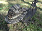
Today I enjoyed the outdoors. I chose to carry......

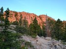
Early start in the Park today.
IMG_20230723_060455916_HDR.jpg
IMG_20230723_055908379_HDR.jpg

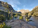
First stop was Loch Lake
IMG_20230723_064113257_HDR.jpg
Lots of trout, and some ducks too.
IMG_20230723_070259445_HDR.jpg

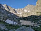
Above a waterfall is Lake of Glass. I thought it was Sky Pond, but that is just a little farther, and hidden from view in the photo.
IMG_20230723_074527982_HDR.jpg
Good view from above the waterfall though.
IMG_20230723_075110487_HDR.jpg
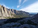
A little break on an isolated perch out of the wind.
IMG_20230723_075346726_HDR.jpg

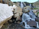
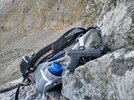
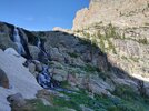
The waterfall (which was also the trail over on the far side there).
IMG_20230723_080737473_HDR.jpg
IMG_20230723_080855923_HDR.jpg

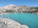
I took the long way back and detoured to Lake Haiyaha.
IMG_20230723_100525653.jpg
Worth it.

Then I passed Dream Lake and Nymph Lake on my way down. But they just weren't as cool.
 
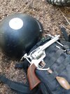
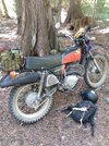
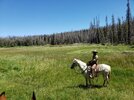
Last week I enjoyed the outdoors camping, and chose to carry.... IMG_20230720_120315326.jpg
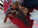
Mostly my EL Patron.
IMG_20230720_120120119.jpg
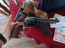
Because I spent some time riding some rough mountain roads on my Hoss. It's grizz country, and my .44Mag might be a better choice, but she's loaded a little "warm", (no no don't freak out, not Ruger loads, not crazy loads, just "kissing" 1,000fps with a 250. And, I don't plink or target shoot with them. I have a light ".45 Colt Special" load with a 230 grain bullet for that. They are for Grizz only. I've only shot a few to make sure they go where the gun is looking) Anyhow, did 50 miles on Thursday, and if you could see some of the road you wouldn't say 50 miles is not much. It was great, I'd stop at the streams and cricks, and dunk my feet in the water. Was a hot day, but not too bad at high elevation. Too hot to stay in camp, which was at low elevation. Anyhow, the EL Patron is nice and light, and sometimes I'd panic thinking that it had fallen out of the holster, as I couldn't really feel it on my hip.
DSC07743.JPG
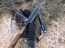
But, I did choose to carry the .44 on a couple of short hikes (too hot to seriously hike) along with my "baddest" spear, with the Cold steel Zulu spear head. Between the .44 (loaded RED HOT) and that spear, I could have spanked Grizz and sent him home crying to his mama. Also had the Cold Steel Bushman knife, which I'm carrying more and more. Very tough knife, good bush-crafting knife. Won't win a beauty contest but you can't break it. And, not actually having a handle, the handle can't become loose no matter how hard you beat on the knife splitting wood. :) It's a good piece of kit, and takes a razor-edge.
DSC07742.JPG
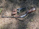
What I never used was my Luger/12guage combo. The 12 for Grizz repellent, with heavy ball loads, and a .410 chamber insert for small game survival. The Luger for Wolf and cougar repellent. The Luger was my Grandfather's, so I like to carry it sometimes for just that reason alone. Usually I prefer to carry a cap-N-ball revolver, or my AirLite .22LR revolver. One thing about the Luger though, it's so dead-nuts laser accurate, one could take bunny wabbits with it no problem.
DSC07744.JPG
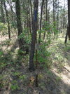
This thing is bad to the bone. Heavy shaft, around seven foot long (at least) or so. And razor sharp. I feel sorry for Mr. Grizz. :)
 
Last week I enjoyed the outdoors camping, and chose to carry....View attachment 1163383
Mostly my EL Patron.
View attachment 1163384
Because I spent some time riding some rough mountain roads on my Hoss. It's grizz country, and my .44Mag might be a better choice, but she's loaded a little "warm", (no no don't freak out, not Ruger loads, not crazy loads, just "kissing" 1,000fps with a 250. And, I don't plink or target shoot with them. I have a light ".45 Colt Special" load with a 230 grain bullet for that. They are for Grizz only. I've only shot a few to make sure they go where the gun is looking) Anyhow, did 50 miles on Thursday, and if you could see some of the road you wouldn't say 50 miles is not much. It was great, I'd stop at the streams and cricks, and dunk my feet in the water. Was a hot day, but not too bad at high elevation. Too hot to stay in camp, which was at low elevation. Anyhow, the EL Patron is nice and light, and sometimes I'd panic thinking that it had fallen out of the holster, as I couldn't really feel it on my hip.
View attachment 1163385
But, I did choose to carry the .44 on a couple of short hikes (too hot to seriously hike) along with my "baddest" spear, with the Cold steel Zulu spear head. Between the .44 (loaded RED HOT) and that spear, I could have spanked Grizz and sent him home crying to his mama. Also had the Cold Steel Bushman knife, which I'm carrying more and more. Very tough knife, good bush-crafting knife. Won't win a beauty contest but you can't break it. And, not actually having a handle, the handle can't become loose no matter how hard you beat on the knife splitting wood. :) It's a good piece of kit, and takes a razor-edge.
View attachment 1163386
What I never used was my Luger/12guage combo. The 12 for Grizz repellent, with heavy ball loads, and a .410 chamber insert for small game survival. The Luger for Wolf and cougar repellent. The Luger was my Grandfather's, so I like to carry it sometimes for just that reason alone. Usually I prefer to carry a cap-N-ball revolver, or my AirLite .22LR revolver. One thing about the Luger though, it's so dead-nuts laser accurate, one could take bunny wabbits with it no problem.
View attachment 1163389
This thing is bad to the bone. Heavy shaft, around seven foot long (at least) or so. And razor sharp. I feel sorry for Mr. Grizz. :)
Great write up. Love the Enduro
 
Great write up. Love the Enduro
Thank you. Yes, that 350XL is a very excellent bike. Not the monster that my Yamaha TT500 was, but it does not lack for power. I have it geared low, usually start in second gear...but 40-45mph is about my top speed. Which is okay, I don't get going over 30mph on those rough and gravely and rocky rutted mountain roads. Unstoppable in first gear, although my dirt-bike-riding-skills are light years away from what they used to be. I used to be a hill climbing fool, but now a steep hill just scares me. :)
 
Thank you. Yes, that 350XL is a very excellent bike. Not the monster that my Yamaha TT500 was, but it does not lack for power. I have it geared low, usually start in second gear...but 40-45mph is about my top speed. Which is okay, I don't get going over 30mph on those rough and gravely and rocky rutted mountain roads. Unstoppable in first gear, although my dirt-bike-riding-skills are light years away from what they used to be. I used to be a hill climbing fool, but now a steep hill just scares me. :)
For me.....one day.......
 
  • Like
Reactions: Ugly Sauce
20230730_120247.jpg

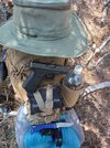
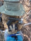
Here's the gun.


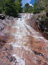
This is Saint Mary's Falls.

20230730_142955.jpg
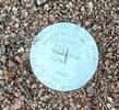
This is a survey marker on the Trail. I'm not sure but If I understand it correctly they mark a section (160 acres square)


Another waterfall down stream from St. Mary's
20230730_133442.jpg

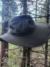
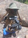
When they say a Tilley hat is waterproof they mean you can wash it in a wash machine they don't mean it's going to keep the water off your head
 
Last edited:
First, I apologize for making a third consecutive post on this.

I was wiped out yesterday. And I had a bunch of stuff going on when I came home so I didn't have time to sit down and put all the photos together.
20230618_123932.jpg
Obligatory Firearms related content. I actually think I took this picture on top of a different mountain in another Canyon on a different day but it is accurate I had all of that stuff with me yesterday too.
20230730_073806.jpg
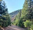
The Road out to the trail. That is gold Camp Road on the other side of that Hill it becomes Old Stage Road and you can actually walk that road all the way out to Victor. Actually you can drive it but you have to start on the other side of that Hill.

20230730_075418.jpg
Facing out from this picture the road goes to the right and over a hill. There used to be a tunnel through the hill but for some reason parks and recs came to Dan and filled it up so you can't go through there anymore. The next time I go out there I'll take a picture of it.
20230730_075929.jpg
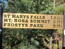
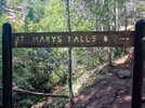
True story bro, None of those distances are right. That's a really old sign and they didn't have GPS tracking and I'm going to show you two other signs in this and the distances add up to being a mile off.
20230730_094114.jpg
Stove Top Mountain. The base of it is at the base of St Mary's Falls.
20230730_095333.jpg

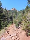
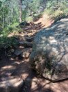
Most of the trail is right along Buffalo Creek. It was actually very cool walking along the trail. It wasn't until I had to switch back and started coming back that it got hot


I know I posted this yesterday but this is kind of Right Where It's at along the trail. I try to make all my videos at least 50 seconds long so that I can put them on YouTube and play them on our TV at home for my wife because she could never walk out there and see it for herself. Anyway that's why at the end of the video I'm telling somebody behind me another 10 seconds because they were butt hurt because they wanted to go in there and film the waterfall.
20230730_095936.jpg
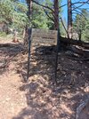
This distance is off by about half.


If you walk past that sign maybe about 30 ft this waterfall is back there.

20230730_104234.jpg
The distance to St Mary's Falls isn't off here but the distance to the top of Mount Rose sure as hell is. It's off by a good mile.


If you look at about the middle of the screen on this video there is a line of rocks and if you're paying attention and you look on the right hand side of the video that blue in the trees is my pack. But the line of rocks is considered the base of St Mary's Falls I was at the base of the base of St Mary's Falls.


This was standing at "The Base". I'm sorry it's a crappy video I couldn't see my phone so I wasn't sure what I was taking video of 20230730_111424.jpg

Photo of the falls 20230730_114604.jpg

Walking back down that cloud is the beginning of a thunderstorm
 
Last edited:
First, I apologize for making a third consecutive post on this.

I was wiped out yesterday. And I had a bunch of stuff going on when I came home so I didn't have time to sit down and put all the photos together.
View attachment 1164309
Obligatory Firearms related content. I actually think I took this picture on top of a different mountain in another Canyon on a different day but it is accurate I had all of that stuff with me yesterday too.
View attachment 1164310
The Road out to the trail. That is gold Camp Road on the other side of that Hill it becomes Old Stage Road and you can actually walk that road all the way out to Victor. Actually you can drive it but you have to start on the other side of that Hill.

View attachment 1164311
Facing out from this picture the road goes to the right and over a hill. There used to be a tunnel through the hill but for some reason parks and recs came to Dan and filled it up so you can't go through there anymore. The next time I go out there I'll take a picture of it.
View attachment 1164312
True story bro, None of those distances are right. That's a really old sign and they didn't have GPS tracking and I'm going to show you two other signs in this and the distances add up to being a mile off.
View attachment 1164313
Stove Top Mountain. The base of it is at the base of St Mary's Falls.
View attachment 1164314

Most of the trail is right along Buffalo Creek. It was actually very cool walking along the trail. It wasn't until I had to switch back and started coming back that it got hot


I know I posted this yesterday but this is kind of Right Where It's at along the trail. I try to make all my videos at least 50 seconds long so that I can put them on YouTube and play them on our TV at home for my wife because she could never walk out there and see it for herself. Anyway that's why at the end of the video I'm telling somebody behind me another 10 seconds because they were butt hurt because they wanted to go in there and film the waterfall.
View attachment 1164315
This distance is off by about half.


If you walk past that sign maybe about 30 ft this waterfall is back there

Where do you carry your bear spray?
And as always Tilly hat jealous 🙂
 
First, I apologize for making a third consecutive post on this.

I was wiped out yesterday. And I had a bunch of stuff going on when I came home so I didn't have time to sit down and put all the photos together.
View attachment 1164309
Obligatory Firearms related content. I actually think I took this picture on top of a different mountain in another Canyon on a different day but it is accurate I had all of that stuff with me yesterday too.
View attachment 1164310
The Road out to the trail. That is gold Camp Road on the other side of that Hill it becomes Old Stage Road and you can actually walk that road all the way out to Victor. Actually you can drive it but you have to start on the other side of that Hill.

View attachment 1164311
Facing out from this picture the road goes to the right and over a hill. There used to be a tunnel through the hill but for some reason parks and recs came to Dan and filled it up so you can't go through there anymore. The next time I go out there I'll take a picture of it.
View attachment 1164312
True story bro, None of those distances are right. That's a really old sign and they didn't have GPS tracking and I'm going to show you two other signs in this and the distances add up to being a mile off.
View attachment 1164313
Stove Top Mountain. The base of it is at the base of St Mary's Falls.
View attachment 1164314

Most of the trail is right along Buffalo Creek. It was actually very cool walking along the trail. It wasn't until I had to switch back and started coming back that it got hot


I know I posted this yesterday but this is kind of Right Where It's at along the trail. I try to make all my videos at least 50 seconds long so that I can put them on YouTube and play them on our TV at home for my wife because she could never walk out there and see it for herself. Anyway that's why at the end of the video I'm telling somebody behind me another 10 seconds because they were butt hurt because they wanted to go in there and film the waterfall.
View attachment 1164315
This distance is off by about half.


If you walk past that sign maybe about 30 ft this waterfall is back there.

View attachment 1164317
The distance to St Mary's Falls isn't off here but the distance to the top of Mount Rose sure as hell is. It's off by a good mile.


If you look at about the middle of the screen on this video there is a line of rocks and if you're paying attention and you look on the right hand side of the video that blue and the trees is my pack. But the line of rocks is considered the base of St Mary's Falls I was at the base of the base of St Mary's Falls

Always quality posts from you man.

I wouldn't be upset if you had 10 consecutive posts.

Keep em coming
 
Yes, bear spray along with a side-arm (or long-gun) is smart. Bear spray alone? Not so smart. As I wind up carrying so much survival junk, I don't often if ever bring the hot-sauce. However, if the little lady is with me, or someone else, I always have them carry it.
My wife has the bear spray! 🙂
 
Where do you carry your bear spray?
And as always Tilly hat jealous 🙂
I carry the bear spray on the chest strap of my pack and I carry crackhead spray in my left front pocket. You're going to be even more jealous when you find out the Tilley only cost me six bucks.

Here's the last couple photos of what I took yesterday 20230730_111241.jpg

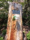
A memorial to a guy named Eamon Murphy. People try to rock climb on the side of the falls and he didn't make it.

20230730_115316.jpg
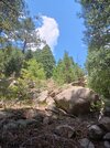
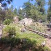
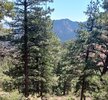
This was along the Mount Rosa trail. I just happened to think it was an interesting group of rocks.
20230730_120417.jpg
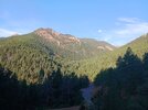
This is just looking across the canyon. That's actually Cheyenne Mountain. It doesn't show up in the photo but the antenna farm for Colorado Springs is all right there on that Peak.

20230730_122627.jpg
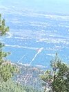
This is looking back down at Colorado Springs. For those who may be familiar with Colorado Springs, the road right down the middle of the photo is Lake Drive where widens it becomes Circle. I can tell what it is because I know what I was looking at but orientated to the picture the bottom of that road is The Broadmoor Hotel and as I said the top of that road is Circle Drive and right where it widens it goes under South Nevada Avenue. For those of you who may have ever been in Colorado Springs.
20230730_143627.jpg
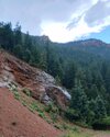
This was the thunderstorm coming over Mount Rosa actually. The rocks to the left that look like they're covered with snow actually had rain seeping out of them.
20230730_071304.jpg
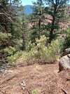
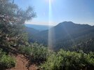
Last photo, I actually took this one at the beginning of the hike and it's looking out from the parking lot at North Cheyenne Canyon
 
First, I apologize for making a third consecutive post on this.
Great pics, nice hiking country. Yeah, three posts didn't make me cry either. I should take more landscape pics, but I only own a phone for emergency use, (the wife made me) or to take a pic, so it's always turned off and in the pack. I've never joined the cult of the cell-phone, and don't keep it handy or use it no matter where I am. I am a photo bug and have a nice camera, but it's too big and heavy to carry it hiking/trekking/hunting. And that's another thing, the cell phone just takes crummy pics compared to my camera.

Glad you take lots of pictures.
 
This is looking back down at Colorado Springs. For those who may be familiar with Colorado Springs,
My dad used to own a pretty big chunk of land near Colorado Springs, close to a little bump in the road called Lake George. I spent many a summer as a teen there wandering the woods with my bow. Corner of the South Platte ran through the property.
 
I carry the bear spray on the chest strap of my pack and I carry crackhead spray in my left front pocket. You're going to be even more jealous when you find out the Tilley only cost me six bucks.

Here's the last couple photos of what I took yesterdayView attachment 1164324

A memorial to a guy named Eamon Murphy. People try to rock climb on the side of the falls and he didn't make it.

View attachment 1164325
This was along the Mount Rosa trail. I just happened to think it was an interesting group of rocks.
View attachment 1164326
This is just looking across the canyon. That's actually Cheyenne Mountain. It doesn't show up in the photo but the antenna farm for Colorado Springs is all right there on that Peak.

View attachment 1164327
This is looking back down at Colorado Springs. For those who may be familiar with Colorado Springs, the road right down the middle of the photo is Lake Drive where widens it becomes Circle. I can tell what it is because I know what I was looking at but orientated to the picture the bottom of that road is The Broadmoor Hotel and as I said the top of that road is Circle Drive and right where it widens it goes under South Nevada Avenue. For those of you who may have ever been in Colorado Springs.
View attachment 1164328
This was the thunderstorm coming over Mount Rosa actually. The rocks to the left that look like they're covered with snow actually had rain seeping out of them.
View attachment 1164329
Last photo, I actually took this one at the beginning of the hike and it's looking out from the parking lot at North Cheyenne Canyon
Keep the.photos coming. All the mountain photos, help those of us that long to be in the mountains, get to the mountains.
Did you catch the Tilley in the bay of the E? I saw one there today for 6 bucks but was suspect of authenticity