The Night Rider
Member
- Joined
- Feb 16, 2022
- Messages
- 2,146
I did an (approximately) 10 mile round trip hike today.
I'm not sure how to explain my route if you're not familiar with Colorado Springs but I went out on the South side of North Cheyenne Cañon to Mount Muscoco then I went down the Sweetwater Cañon trail (in Sweetwater Cañon to the Daniel's Pass/Bruin trail (it was about 3 miles longer than I expected) down to Helen Hunt Falls then back on the North side of the Cañon on the Columbine Trail.
Here's the route on the map in orange

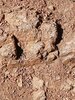
This rock is right in the middle of the trail.

Looking down at Colorado Springs
Sweetwater Cañon

There ain't a drop of water in that Cañon.
That Granite face is the very top of Helen Hunt Falls. It's the head of the Cañon. EDIT: I probably should clarify that it's the head of North Cheyenne Cañon.

Same line up as last week

I'm not sure how to explain my route if you're not familiar with Colorado Springs but I went out on the South side of North Cheyenne Cañon to Mount Muscoco then I went down the Sweetwater Cañon trail (in Sweetwater Cañon to the Daniel's Pass/Bruin trail (it was about 3 miles longer than I expected) down to Helen Hunt Falls then back on the North side of the Cañon on the Columbine Trail.
Here's the route on the map in orange
This rock is right in the middle of the trail.
Looking down at Colorado Springs
Sweetwater Cañon
There ain't a drop of water in that Cañon.
That Granite face is the very top of Helen Hunt Falls. It's the head of the Cañon. EDIT: I probably should clarify that it's the head of North Cheyenne Cañon.
Same line up as last week
Last edited:


")